Satellite Technology in Weather Forecasting
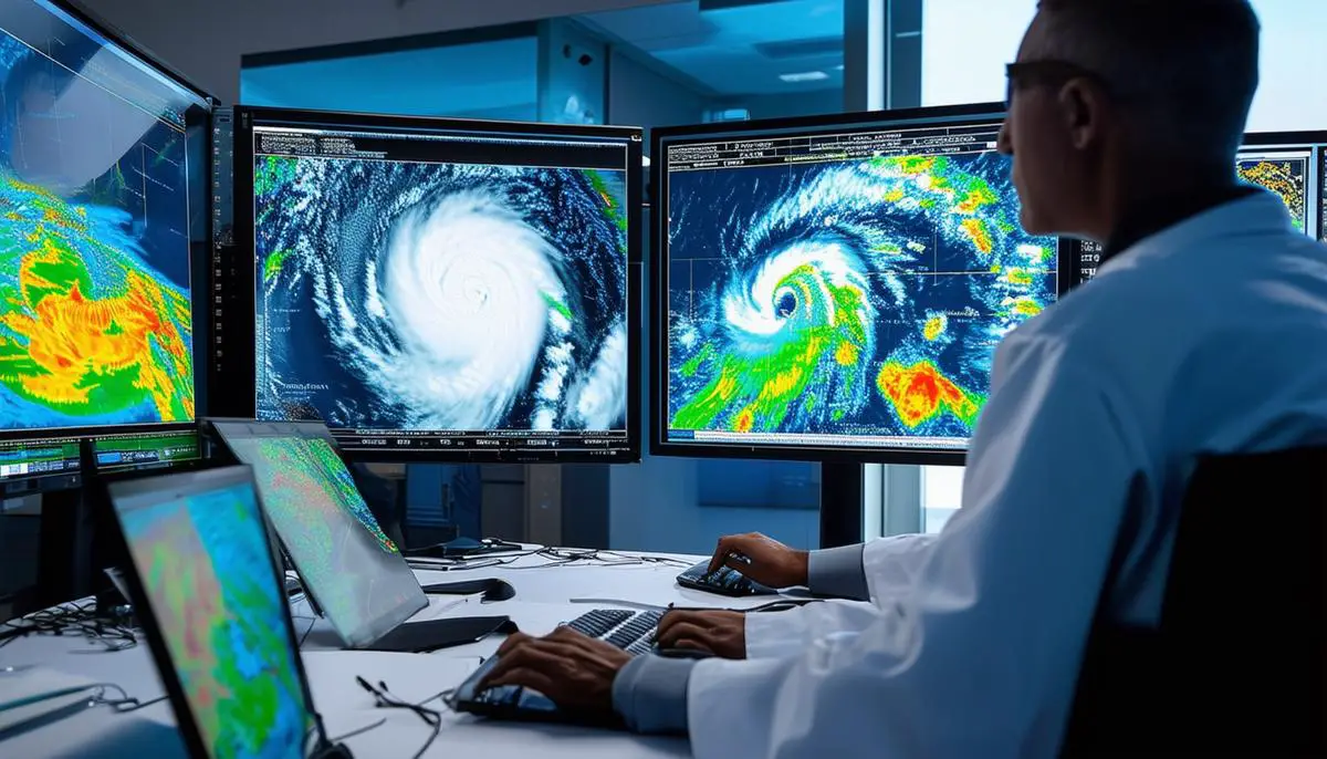
In 2020, severe storms caused billions in damage across the Midwest. Penn State scientists improved forecasts by integrating satellite data with computer models, focusing on derechos—fierce storm lines—to predict areas of strongest winds.
Yunji Zhang's team demonstrated the value of combining satellite observations with traditional methods, particularly in areas where radar is ineffective. By utilizing integrated infrared and microwave readings, they uncovered crucial details hidden beneath clouds, enhancing local forecasts and showing potential for regions with limited observational tools.
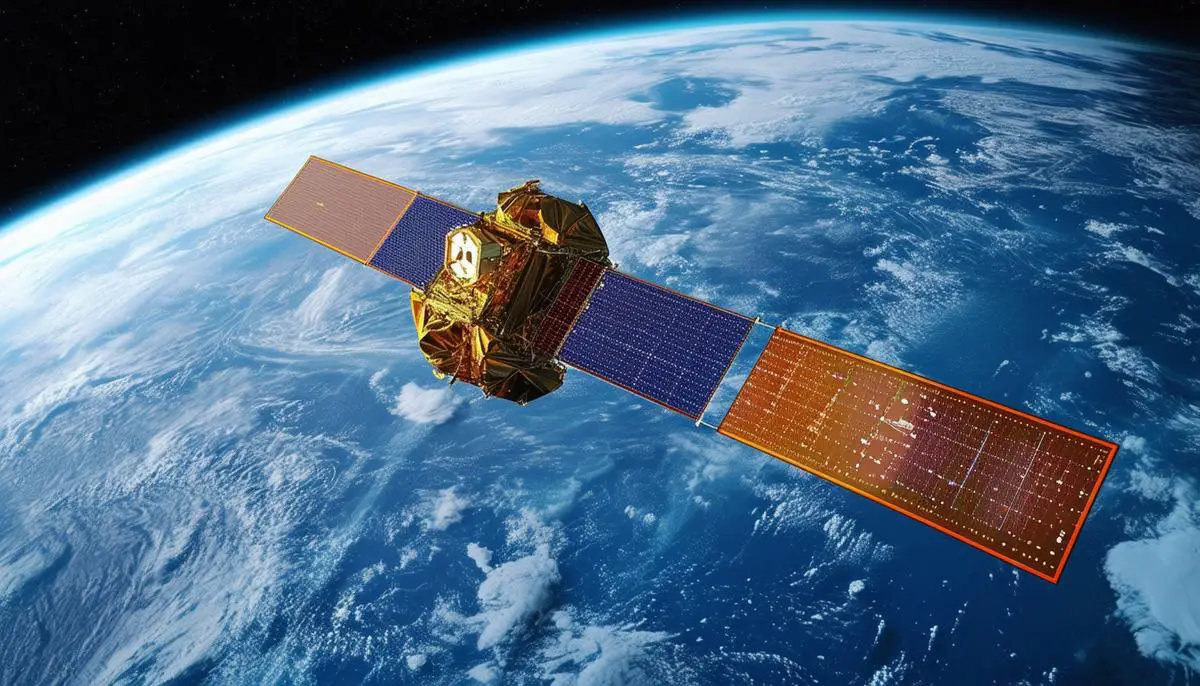
NOAA's satellites, part of the international COSPAS-SARSAT system, aided in hundreds of rescues across the US. The Surface Water Ocean Topography (SWOT) satellite mission, a collaboration among NASA and global partners, aims to provide accurate water measurements and track climate change impacts, offering precision crucial for water resource management and natural disaster preparation.
Steven Greybush's team at Penn State is applying artificial intelligence to meteorology, using computational tools to predict thunderstorm formations by analyzing cloud patterns. Supported by a National Science Foundation grant, they aim to explain thunderstorm formation mechanics, potentially improving emergency response to weather disasters.
In Europe, Eumetsat, a cooperative effort among thirty countries, provides broad weather monitoring and early storm alerts, sharing data with Africa to assist regions with limited space resources. This collaboration offers not only captivating space imagery but also the potential to predict precise weather impacts, such as Saharan dust landfall.
Access to sophisticated satellite data has revolutionized our understanding and preparedness, transforming weather mysteries into actionable insights.
Impact of Climate Change on Weather Patterns
The Surface Water Ocean Topography (SWOT) satellite exemplifies the evolution of satellites from static observers to dynamic instruments in understanding and mitigating climate-related impacts. SWOT's mission involves capturing precise measurements crucial for comprehending shifting climate patterns, examining water storage variations and rising sea levels.
SWOT's data is applied to real-world challenges like water resource management and extreme weather event forecasting. It allows researchers to track micro-shifts in lakes, rivers, and oceans, providing a comprehensive picture of hydrological changes due to climate upheavals.
The satellite's granular data gathering empowers communities worldwide, informing emergency planning and enhancing disaster readiness. From Vermont's floods to Libya's severe weather events, SWOT's precision can significantly impact survival outcomes in natural calamities.
Key Applications of SWOT Data:
- Tracking rising sea levels
- Monitoring changes in water storage
- Enhancing flood prediction models
- Informing urban planning strategies
- Supporting flood insurance assessments
SWOT's advanced detection of ocean features and their relationship to heat and carbon capture promises to revolutionize predictive models. By refining assessments of droughts and rising seas, it provides a roadmap for future readiness, supporting urban planning and financial safeguards like flood insurance.
This satellite technology synthesis demonstrates that while climate change presents challenges, it also enables us to better prepare for its impacts, forging a proactive path in our evolving understanding of Earth's systems.
AI and Machine Learning in Weather Prediction
The integration of artificial intelligence (AI) and machine learning into weather prediction represents a significant advancement in comprehending and anticipating atmospheric phenomena. Steven Greybush's team is at the forefront, combining computational power with traditional meteorological knowledge.
Machine learning algorithms excel at deciphering complex data patterns, offering a new perspective on thunderstorm prediction. By analyzing vast amounts of satellite imagery data, including cloud thickness and atmospheric moisture, AI can identify spatial patterns that human analysts might overlook.
These AI systems promise more accurate Numerical Weather Prediction (NWP) simulations, a cornerstone of modern meteorological forecasts. Integrating AI models with NWP refines predictions for abrupt weather events, leading to more reliable forecasts. This approach has potential applications for studying weather conditions on Mars, where dust storms pose significant challenges to missions.
"Weather has huge impacts on society. The more accurately we can forecast the weather and communicate what we are predicting, the better society will be able to prepare for these extreme weather events." – Steven Greybush
The research leverages high-performance computing and extensive atmospheric datasets, allowing for rapid processing and nuanced interpretation. By synthesizing simulation results with real-world observations, researchers are moving towards creating more definitive forecasts, critical for emergency planners and decision-makers.
AI's fusion with meteorology drives ambitious strides in understanding weather systems across different planets. Examining parallels and variances between Earth's and Mars' meteorological dynamics allows scientists to recalibrate existing weather models, enhancing their accuracy and showcasing the versatility of computational creativity in scientific inquiry.
As AI capabilities in weather science continue to advance, our ability to predict and prepare for atmospheric phenomena improves, empowering humanity with enhanced foresight and resilience both on Earth and in preparation for exploration beyond.

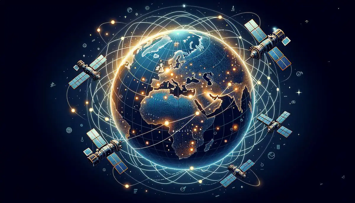
Global Collaboration in Satellite Weather Monitoring
International collaboration is key to addressing the challenges posed by climate change. Eumetsat, a European satellite program, exemplifies this cooperative spirit, bringing together over thirty European nations to operate a fleet of weather satellites.
These satellites monitor Europe's weather and extend their coverage across borders and oceans, providing real-time data that informs weather models with high accuracy. Eumetsat's commitment to inclusivity ensures that regions with limited resources, particularly in Africa, benefit from early warning systems and improved weather monitoring capabilities.
Benefits of Global Satellite Collaboration:
- Enhanced early warning systems
- Improved agricultural strategies
- Better urban planning
- Refined climatic models
- Proactive natural disaster responses
The shared data repositories inform a wide range of applications, from agricultural strategies to urban planning. Better forecasts and refined climatic models enable nations to develop proactive responses to mitigate the effects of natural disasters.
Cross-pollination of ideas and technologies among international partners expands the boundaries of meteorological research. Scientists from diverse backgrounds collaborate to cultivate innovative solutions, driving advancements in satellite instruments and analytical frameworks.
These global collaborations underscore that climate change and severe weather transcend geopolitical boundaries, requiring united efforts. Programs like Eumetsat foster collective resilience rooted in shared knowledge and mutual respect.
By bringing nations together for weather monitoring, the international community enhances its scientific capabilities and champions a vision of planetary stewardship. This cooperative approach demonstrates what can be achieved when curiosity, cooperation, and compassion converge, promising a future of improved understanding and management of global weather systems.
The integration of satellite technology in weather forecasting represents significant progress in enhancing our understanding and preparedness against nature's unpredictable forces. By leveraging cutting-edge tools and fostering global collaboration, we are developing a future where weather's complexities are transformed into actionable insights, empowering communities worldwide.
- Zhang Y, Stensrud D, Clothiaux E, Chen X. Improving forecasts of severe weather events using satellite data. Geophys Res Lett. 2023.
- National Oceanic and Atmospheric Administration. NOAA satellites aided in 350 rescues in 2023. NOAA News. 2024.
- National Aeronautics and Space Administration. Surface Water and Ocean Topography Mission. NASA Earth Science. 2023.
- Greybush S, Gagne DJ. Artificial intelligence for weather prediction. Penn State Institute for Computational and Data Sciences. 2023.
- European Organisation for the Exploitation of Meteorological Satellites. Eumetsat satellite programme. Eumetsat. 2023.
![]()