Understanding Earth's Crust
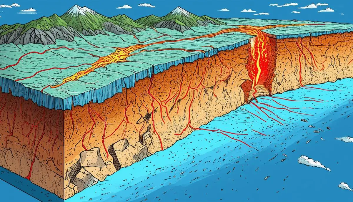
The Earth's crust, the outermost layer of our planet, encompasses both continental and oceanic crusts, each with distinct characteristics and compositions. Continental crust is thicker, ranging between 25 to 70 kilometers, and consists primarily of lighter rock types like granite and sedimentary rocks. These minerals are rich in silicon and aluminum, contributing to the crust's buoyancy. In contrast, oceanic crust is thinner, about 5 to 10 kilometers, and is mainly composed of denser basalt formed from rapidly cooled lava at mid-ocean ridges.
Earthquakes, driven by the movements of tectonic plates beneath the Earth's crust, originate primarily at faults—kinks or breaks in the crust. These faults are more prevalent near tectonic plate boundaries but can also appear in the interiors of plates, giving rise to intraplate earthquakes. The elastic rebound theory explains that stress builds up along faults until rocks snap back to their initial positions after overcoming the friction locking them in place. This sudden release results in waves of energy radiating outward, perceived as tremors.
Understanding the geological characteristics of the crust helps explain the uneven distribution of earthquakes, which tend to cluster near the junctures of tectonic plates. The density and composition of continental versus oceanic crust can also influence the magnitude and frequency of seismic activity experienced in those areas.
Mechanics of Earthquakes
Earthquakes occur predominantly due to the movement and interaction of tectonic plates, with fault lines along their margins being the most likely locations for seismic activity. As plates move, strain accumulates at these fault boundaries due to the resistance encountered. This strain builds until the stored energy surpasses the frictional force holding the rocks together, causing them to suddenly shift into new positions.
This sudden release of energy propagates seismic waves that radiate outward from the fault, causing the surrounding terrain to experience tremors of varying intensity, depending on the magnitude of the waves and local geological conditions. Seismic waves are classified into body waves (P and S waves) and surface waves (Love and Rayleigh waves). P waves are compressional and move in the direction of wave propagation, while S waves are shear waves moving perpendicular to the direction of propagation and only through solid materials. Surface waves generally cause more damage due to their higher amplitudes and prolonged motion.
Understanding the dynamics of earthquakes is crucial for mitigating risks, enhancing building strategies, and saving lives and properties. The study of seismic activities also provides insights into the Earth's interior configurations, contributing to our understanding of planetary sciences.
Depth of Earthquakes
The depth at which an earthquake occurs provides critical insights into its potential impact on the surface. Earthquakes are categorized based on their depths:
- Shallow (less than 50 kilometers)
- Intermediate (50 to 300 kilometers)
- Deep (300 to 700 kilometers)
The majority of earthquakes are shallow, occurring within the crust or uppermost portion of the mantle.
Shallow earthquakes are notable for their immediate and severe impact, as they release energy over a smaller area with greater intensity. The proximity to the surface does not allow much room for energy dispersal, resulting in more potent ground shaking and surface damage. Intermediate and deep-focus earthquakes occur within subducting slabs as they plunge into the mantle beneath overriding plates. Although their energy must travel farther to reach the surface, losing some strength along the way, they can still cause significant disturbances.
The depth of earthquakes is determined by several tectonic factors, such as the type of plate boundary and the structure and properties of the involved geological layers. Stressed rock breaking points and thermal conditions influence whether a fault slip will occur near the surface or deeper in the crust. Shallow quakes also tend to produce more aftershocks, leading to extended periods of seismic activity that can continue to affect the stability of structures and landscapes over time.
Understanding earthquake depths helps scientists better predict potential impacts in various regions and contributes to improved building codes and infrastructure planning. This knowledge is invaluable in safeguarding communities against future seismic events and enhancing resilience to one of nature's most formidable forces.
Measuring and Locating Earthquake Depths
Measuring and locating the depths of earthquakes with precision is critical for understanding the Earth's geophysical attributes and designing effective responses to natural disasters. Seismologists utilize a network of seismometers, devices that measure ground motion, to collect data crucial for pinpointing the earthquake's focus or hypocenter, which includes its depth. The epicenter, the point on the Earth's surface directly above the hypocenter, is estimated through triangulation using seismic data from at least three different seismometer locations.
The accuracy of depth measurement depends on the density and spatial distribution of seismic stations. In well-monitored regions with dense networks of seismometers, specialists can determine seismic event specifics, including depth, with high accuracy, typically within 1 kilometer or less. However, in regions with sparse seismic coverage, precise depth calculation becomes more challenging, increasing uncertainty and potentially skewing the understanding of an earthquake's characteristics.
To mitigate these challenges, scientists deploy arrays of Ocean Bottom Seismometers (OBS) to gather data from oceanic plates, where most tectonic activity occurs. They also use global satellite positioning systems and remote sensing techniques to infer depth estimates from minute changes in the Earth's surface following large earthquakes.
Accurate depth determination is pivotal for comprehending the geometry and internal structure of the Earth, as different depth zones can reveal diverse behaviors and characteristics of fault lines and seismicity. Precise seismic studies help unearth the dynamics of tectonic movements and safeguard populations through informed urban planning that considers seismic foresight.

Impact of Crust Depth on Earthquake Dynamics
The variance in crust thickness between oceanic and continental settings significantly affects the characteristics and potential risks associated with earthquakes. Oceanic crust, which is thinner and denser than continental crust, allows for a more efficient transfer of seismic waves. As a result, shaking and subsequent damage can be more pronounced near the epicenter, but the intense energy released can also dissipate more promptly.
Continental crust, being thicker and more complex, provides various pathways that can reflect and refract seismic waves. This complexity can both amplify and attenuate seismic waves based on the sub-surface structures they encounter, increasing the risk and unpredictability of damage caused by earthquakes in diverse geological settings like mountain ranges or sediment-filled basins.
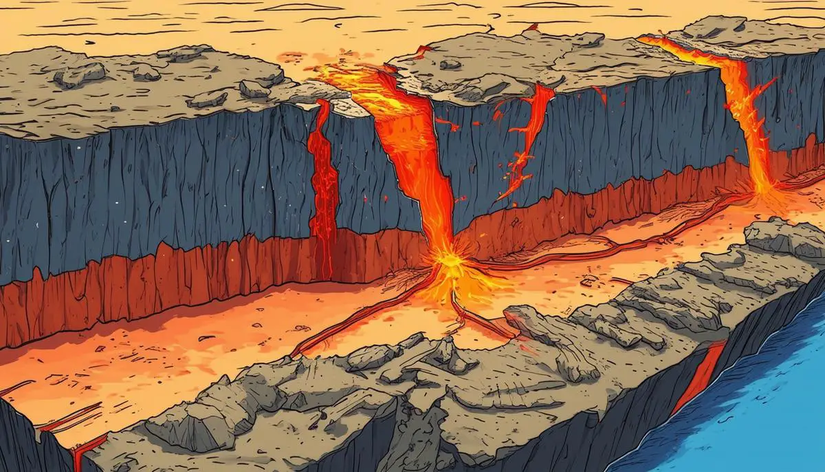
Plate boundaries, where tectonic plates interact, expose sharp contrasts in how earthquakes manifest between oceanic and continental crusts. At oceanic spreading centers, such as mid-ocean ridges, numerous smaller-magnitude earthquakes occur due to the constant creation of new crust. In contrast, continental rift areas experience less frequent but potentially more powerful quakes due to the thicker and less homogeneous crust within which stresses accumulate over longer periods before being released.
Subduction zones, where oceanic crust is subducted beneath continental crust, often create interplate earthquakes that are quite deep and can lead to remarkable phenomena like volcanic activity. The thickness and elasticity of the continental crust plate play a role in determining both the depth and the subsequent dissipational pathways of seismic energies.
The implications of these foundational differences extend directly into risk management and urban planning strategies. Regions with significant population centers near plate boundaries characterized by oceanic versus continental transitions must be particularly diligent about engineering structures to withstand potential large-magnitude quakes. Effective seismic planning must consider crustal characteristics to optimize resilience to earthquakes.
The interplay between crustal depth and earthquake dynamics is a critical aspect of geophysical research that enhances our ability to forecast seismic activities and bolster community resilience. By understanding these fundamental interactions, we can fortify our preparedness for future seismic challenges and mitigate the hazardous impacts of earthquakes on human environments.
- Shearer PM. Introduction to Seismology. 2nd ed. Cambridge University Press; 2009.
- Stein S, Wysession M. An Introduction to Seismology, Earthquakes, and Earth Structure. Blackwell Publishing; 2003.
- Lay T, Wallace TC. Modern Global Seismology. Academic Press; 1995.
- Scholz CH. The Mechanics of Earthquakes and Faulting. 3rd ed. Cambridge University Press; 2019.
![]()